
Snow Time Machine

Taunton, MA

Remarkable storms and the local record, winter by winter.

Choose a city archive
Snow Time Machine

Explore a winter

Pick a winter to see the snow that fell, from the first flakes to the last storm.

Search more storms by state, decade and type →
When the first flakes arrivedNWS Boston/Norton · verified first-snow reporting dates

Earlier · Oct 29Later · Jan 7

Higher dots mean an earlier arrival in this sample. Swipe or use the arrows, then choose a year.

Regional comparison · Feb 6 – Feb 7, 1978

New England, buried in history.

The February 1978 blizzard stranded traffic and left a remarkable range of storm totals across southern New England.

Measurements apply to their named reporting locations.
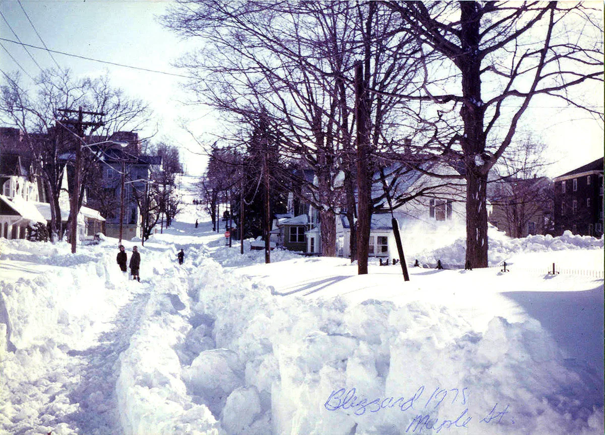
Maple Street, Woonsocket, Rhode Island, February 1978, about a week after the storm. Historical photograph by Dahoov2.
Documentary photograph · Maple Street, Woonsocket, Rhode Island · February 1978, about a week after the storm. Dahoov2 / Wikimedia Commons · Public domain. Resized and converted to WebP; no content alteration.
Same event. Different places.
Boston27.1 inches
storm-total snowfall
Providence27.6 inches
storm-total snowfall
Woonsocket38 inches
storm-total snowfall

A meteorologist recalls forecasting the New England blizzard.

Read the original historical coverageCBS Boston · Jan 28, 2018 · retrospective
Sources & event details

Regional event · southern New England. Snowfall values are named-place storm totals from the NWS retrospective.

Boston: 27.1 inches · storm-total snowfall. Measurement source ↗

Providence: 27.6 inches · storm-total snowfall. Measurement source ↗

Woonsocket: 38 inches · storm-total snowfall. Measurement source ↗

Blizzard Of '78: Barry Burbank's Memories Of The Historic Storm ↗
CBS Boston · Jan 28, 2018

A regional storm does not establish the first seasonal snowfall at your city.

The station record

Daily snowfall reports · 1977–78

NWS Boston/Norton · nearby station, 7 km away

Opening station records…

Same winter. Another place.
Discover the earliest & latest arrivals

Among the 25 snowy complete seasons at NWS Boston/Norton.

Every complete season (25) NWS Boston/Norton · 1994–2025
First measurable snowfall at NWS Boston/Norton; separate from the site's reviewed typical-date and guessing sample.
WinterReporting dateFirst-day snowfall
2024–252024-12-050.71 inches
2023–242024-01-071.61 inches
2022–232022-12-110.12 inches
2020–212020-10-313.7 inches
2019–202019-12-023.11 inches
2018–192018-11-165.2 inches
2017–182017-12-103.9 inches
2016–172016-12-050.2 inches
2015–162015-12-290.59 inches
2014–152014-11-030.31 inches
2013–142013-12-090.39 inches
2011–122011-10-290.79 inches
2010–112010-11-080.39 inches
2007–082007-11-200.12 inches
2006–072006-12-041.5 inches
2005–062005-10-290.71 inches
2004–052004-11-121.1 inches
2003–042003-12-053.58 inches
2002–032002-11-275.12 inches
2001–022001-12-080.71 inches
2000–012000-12-081.61 inches
1998–991998-12-245.2 inches
1997–981997-11-141.5 inches
1996–971996-11-271.5 inches
1994–951994-11-280.51 inches
Original historical source ↗

Single-station record; observation sites and practices may change. Source SHA256: 7e6a779fe6c5556c7d93b0020baa27fda644ba5514e67fd4439d6933d38168a3.